Plan Metrics Window
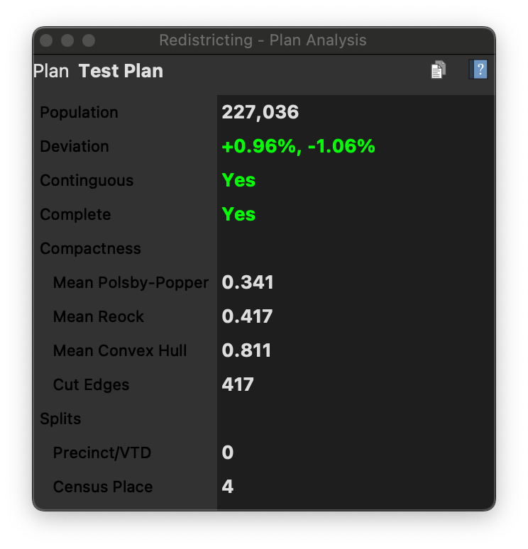
The Metrics Table shows planwide metrics for your plan, including total population, deviation, mean compactness scores, and split geographies for each of the additional geographies in your plan.
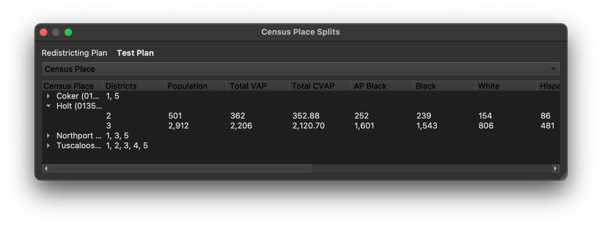
Double clicking on split geography entry in the Metrics Table will display detailed information about the splits, including the districts between or among which the geographic unit is split, and the population assigned to each of the split piece.